
ALTA Land Survey Details Developers Should Check Before Site Design

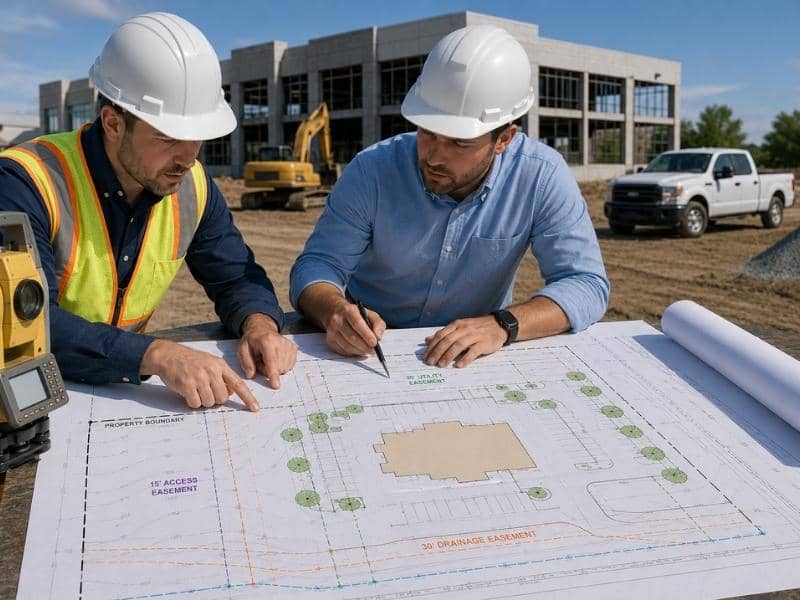
ALTA land survey details developers should check before site design showing a surveyor and developer reviewing property boundaries, easements, utilities, and building layout.

Site design decisions depend on accurate property information. An ALTA land survey provides that information in precise detail. Developers need to understand what data inside an ALTA land survey affects their site plans. Without reviewing these details carefully, designers might place buildings on restricted land, position utilities incorrectly, or miss access limitations. Checking ALTA land survey details early prevents design changes that waste time and money.

How ALTA Land Survey Boundary Details Affect Building Placement

An ALTA land survey shows exact property boundaries with precision. These boundaries define the outer edge of where you can build. Developers must check whether the boundary lines match what they expected from the deed and tax parcel information.

The ALTA land survey often reveals differences between what the deed claims and what actually exists on the ground. Old plats might have errors. Boundaries might shift over time. A survey catches these discrepancies before design begins.

Developers should check the following from boundary information:

Whether the parcel is the size and shape the deed describes. If an ALTA land survey shows 9.8 acres instead of the claimed 10 acres, the building program changes. If the shape is narrower or more irregular than expected, parking and circulation change. Whether the boundary line passes through what you planned as a building location. If a corner clip or boundary angle cuts into a planned area, the building must move. Whether neighbors encroach onto your land with fences or structures. If the ALTA land survey finds encroachments, you need to address them before design finalizes.

What ALTA Land Survey Easement Data Shows About Site Restrictions

Easements carved into an ALTA land survey are the most important constraints on site design. An easement is a recorded right that lets someone else use part of your land. You cannot build structures in most easements. These restrictions shrink your buildable area significantly.

Developers need to study the exact location of every easement shown on the ALTA land survey. Utility easements run for power, gas, water, sewer, and telecommunications. Drainage easements protect swales and creek channels. Access easements allow neighbors or public agencies to cross your land. Each type affects site design differently.

What an ALTA land survey easement shows that developers must check:

The precise location and width of each easement so you know exactly where you cannot build. The easement type so you understand what activity is protected. Whether landscaping, paving, or minor structures are allowed within the easement. Some easements allow limited surface use if utilities are not disturbed. The depth of utility easements because some utilities are shallow and some are deep.

How ALTA Land Survey Information Guides Parking and Circulation Routing

Parking and circulation paths must follow areas that are free of easements and other restrictions. An ALTA land survey shows you exactly where these clear areas sit. This prevents designers from creating circulation plans that cannot actually be built.

Developers should verify that parking lot placement sits outside utility and access easements. They should confirm that driveway routes avoid easement areas. They should check whether access easements that cross the property create conflicts with planned circulation.

An ALTA land survey also shows existing driveways and access points. Developers need to understand whether they must continue using these existing access points or whether they can create new ones. If the ALTA land survey shows a legal requirement to maintain access to a neighboring property, circulation design must accommodate this requirement.

What ALTA Land Survey Utility Information Means for Site Infrastructure Planning

Utilities shown on an ALTA land survey include existing pipes, cables, and their locations. This information prevents you from placing new buildings or utilities where conflicts would occur. An ALTA land survey that shows utility locations prevents expensive collisions during construction.

Developers should check the utility easement depths because this determines how deep you can excavate for foundations and drainage. They should verify the utility routing so they understand where utilities enter the property and where they exit. They should identify utility company connections because utilities must be accessible for repair and maintenance.

ALTA land survey information about utilities matters because:

It shows you where utility companies have access rights. Building over these areas without proper coordination creates problems. It reveals buried utilities that do not have recorded easements but still exist on the property. It helps you plan new utility connections that avoid conflicts. It shows you whether utilities are adequate for your building program or whether you need new capacity.

How ALTA Land Survey Access Details Affect Overall Site Design

Access and circulation rights are recorded on an ALTA land survey when they are formally documented. Developers need to verify that their planned site layout respects all recorded access rights and limitations.

An ALTA land survey shows whether neighbors have legal rights to cross your property to reach their land. It shows whether public agencies have recorded access for drainage maintenance or other purposes. It reveals whether private roads serve the property and what rights you have to use and maintain them.

Developers should verify that planned circulation accommodates all required access while keeping the site design functional. They should understand whether access rights change during different seasons or conditions. They should know whether they must maintain certain access routes or can close them during construction phases.

Frequently Asked Questions

What does an ALTA land survey show that a regular survey does not?

An ALTA land survey is more detailed than a standard boundary survey. It includes title research about recorded easements, restrictions, and access rights. It provides the level of detail developers need for site design and municipal approval.

Why should developers check ALTA land survey details before hiring architects?

ALTA land survey details show the buildable area after subtracting easements and restrictions. Designers need this information to create feasible site plans. Checking early prevents design changes later.

Can a developer ignore easements shown on an ALTA land survey?

No. Easements are recorded legal restrictions. Building in an easement area can result in forced removal of structures and legal liability. ALTA land survey easements must be respected in every design.

What happens if site design conflicts with ALTA land survey restrictions?

The design must change to match the survey information. Conflicts discovered during municipal review delay approval. Finding conflicts early through ALTA land survey review is much faster.

Does an ALTA land survey show zoning information?

Standard ALTA land surveys do not include zoning. However, you can request zoning information as an add-on item when ordering the ALTA land survey.

ALTA Survey Red Flags That Can Slow Down a Commercial Loan

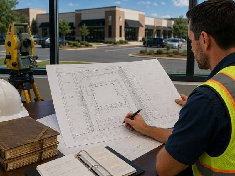
ALTA survey review for a commercial property showing site details that lenders examine before approving a commercial loan.

An ALTA survey often shows details that lenders care about. They check this before approving a commercial loan. This kind of survey maps the property in close detail. It shows buildings, driveways, easements, and other features. It shows them exactly as they sit on the ground today. Lenders use this information to spot risks. They want to catch problems before funding a deal. A few common findings can slow down approval if nobody catches them early. Knowing these red flags can help buyers move through the loan process faster.

An ALTA Survey May Show Buildings Near Property Lines

An ALTA survey can show where a building, sign, or parking area sits. Sometimes one of these sits close to a property line. A structure might cross the line by just a few inches. Sometimes it sits right at the edge with no room to spare. Lenders often want a closer look when this happens. A structure too close to a boundary can raise questions. These questions often involve zoning rules or future use. This kind of finding does not always stop a loan. It usually slows down the review instead.

Shared Driveways Can Create Questions

An ALTA survey may uncover a driveway or entrance used by more than one property. This kind of shared access often works fine day to day. It can still raise questions during a loan review. A lender wants to know one thing. Is the right to use that driveway actually recorded? Commercial buyers should understand these shared areas before closing. A shared driveway without clear recorded rights can cause a problem. It can hold up financing until the access gets sorted out.

Easements Found During an ALTA Survey Can Affect Plans

An ALTA survey can reveal utility lines, access rights, or other easements. These often cross the property in different ways. Some of these easements sit underground and stay out of sight. Others cut across open land that a buyer planned to use. These easements may limit how certain parts of the property get used. They may also limit what gets built there. A lender wants to know about any easement that could affect future plans. Finding this information early helps buyers plan around it. It helps them avoid a surprise later.

Site Features Do Not Always Match the Records

Fences, buildings, and paved areas do not always match what the legal documents describe. A fence might sit in a different spot than the recorded line. A parking area might extend past where the deed says it should stop. An ALTA survey helps spot these differences. It catches them before they become bigger problems. Lenders take note when site conditions and paperwork disagree. Catching this gap early gives buyers a chance to fix it. It helps them avoid delays once the loan is already moving forward.

Finding Problems Early Can Help Avoid Loan Delays

Ordering an ALTA survey early gives buyers more time. They can review and solve any issues that come up. A boundary question or easement concern is much easier to handle early. It gets harder once the loan is far along. Waiting until the last minute leaves little room to fix anything. Ordering the survey early keeps the loan process moving toward closing. It also gives buyers, lenders, and title companies more time. They can work through any concerns together.

Frequently Asked Questions

What is an ALTA survey?

An ALTA survey is a detailed survey. It supports many commercial property purchases and loans. It maps the boundaries, buildings, and other features on the property.

Why do lenders ask for an ALTA survey?

Lenders use an ALTA survey to learn more about the property. They check it for possible concerns. This helps lenders understand the risk before approving a loan.

Can an ALTA survey uncover problems?

Yes, an ALTA survey may reveal easements, access issues, or differences between records and site features. These findings can affect how a lender views the property. Catching them early gives buyers time to respond.

Who usually orders an ALTA survey?

Commercial property buyers, lenders, and title companies often request an ALTA survey. Each group uses the survey for a different reason. Together, they rely on it to move the loan process forward.

When should an ALTA survey be ordered?

It is best to order an ALTA survey early. This gives buyers time to review any questions before closing. Ordering early keeps the loan process on track.

What an ALTA Land Survey Reveals That a Title Search Cannot

Engineer and commercial property professionals reviewing plans and discussing what an ALTA Land Survey reveals that a title search cannot.

A title search and an ALTA Land Survey serve different purposes. One cannot replace the other. If you’re buying, selling, or financing commercial property, it’s important to know what each one does.

A title search reviews the property’s legal history through public records. It can uncover ownership records, easements, liens, and other legal issues tied to the property. An ALTA Land Survey focuses on the property itself. A surveyor visits the site to locate boundary lines, buildings, access points, and other physical features.

Together, a title search and an ALTA survey provide a more complete picture of a property before a real estate transaction closes.

What a Title Search Does

A title search is a review of public records. A title company or attorney looks through past property transfers to make sure ownership is clear and to find any legal issues connected to the property.

A title search may uncover unpaid taxes, liens, deed restrictions, ownership disputes, and recorded easements. This information is important because it helps buyers and lenders understand potential risks before closing.

However, a title search only looks at documents. It does not confirm what exists on the property today. If a fence was moved years ago or a utility line was installed without being properly recorded, those issues may not appear in public records.

What an ALTA Land Survey Does

An ALTA Land Survey involves fieldwork. A licensed surveyor visits the property to measure and document conditions on the ground. The survey identifies property boundaries, buildings, improvements, access points, and other features that could affect ownership or use of the property.

This process helps uncover issues that public records may miss. For example, a building may cross a property line, a driveway may be shared with a neighboring property, or a structure may be too close to a boundary line. These problems may not appear in legal documents, but they can still create challenges for property owners.

ALTA surveys follow national standards created by the American Land Title Association (ALTA) and the National Society of Professional Surveyors (NSPS). These standards help ensure surveys are accurate and consistent across the country.

Physical Issues a Survey Can Find

Some property issues can only be found by visiting the site.

One common problem is encroachment. This happens when a fence, building, or other structure crosses a property line. Even if it has existed for years, it can still create legal concerns.

Shared driveways are another example. Two neighboring properties may use the same driveway, but the arrangement may not be clearly documented. A survey helps identify these situations before a sale is completed.

Utility lines can also create issues. Power, water, gas, and communication lines often cross private property. Some have recorded easements, while others may not. A survey helps show where these features are located.

How an ALTA Survey Works With a Title Search

A title commitment lists legal matters that may affect the property, such as easements, restrictions, and rights of way. An ALTA survey helps show where those items are located on the property.

For example, a title commitment may mention a utility easement. The survey can help determine where that easement is located and whether it affects buildings, access, or future development plans.

This is one reason lenders often require ALTA surveys for commercial real estate transactions. The survey helps identify risks that may not be clear from public records alone.

Frequently Asked Questions

What can an ALTA Land Survey reveal that a title search cannot?

An ALTA Land Survey shows physical conditions on the property that may not appear in public records. This can include buildings or fences crossing property lines, shared driveways, utility features, and other site conditions that could affect ownership or property use.

Does a title search verify property boundary lines?

No. A title search reviews legal records and ownership history, but it does not confirm where boundary lines are located on the ground. A licensed surveyor must perform a survey to determine property boundaries.

Can an ALTA survey find unrecorded easements?

Sometimes. A surveyor may find signs of utility lines, access routes, or long-term property use that suggest an easement exists. While the survey does not create or prove an easement, it can help identify issues that need further review.

Why do lenders require an ALTA survey for commercial transactions?

Many lenders require an ALTA survey because it helps identify boundary issues, access concerns, and other property conditions that may affect the property’s value or use. It also helps title companies provide broader insurance coverage.

Can a title search replace an ALTA Land Survey?

No. A title search reviews legal records, while an ALTA Land Survey documents physical conditions on the property. Both provide important information and are often used together in commercial real estate transactions.