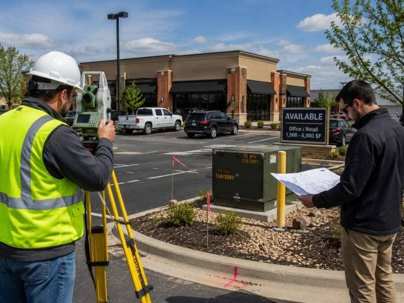
Most deals don’t fall apart because of a bad survey. They stalled because someone ordered the ALTA survey three weeks before closing, then acted shocked when the boundary didn’t match the deed. The survey sits right in the middle of almost every commercial purchase. Buyers who treat it as a last-minute task end up asking for an extension they never needed.
Order it early. That’s the short version. The rest of this explains why the clock runs the way it does.
When should a buyer order an ALTA survey?
Order it in the first week of due diligence, right next to the title work and the environmental report. The survey needs record research, fieldwork, drafting and at least one round of review. Any one of those steps can turn up a question that takes days to sort out.
Ordering early won’t make the drafting faster. It buys you room at the end, which is where buyers always run short. Say the surveyor finds a fence crossing the line or a gap in the legal description. Someone has to decide what to do about it. That talk goes much better with four weeks left than with four days.
The title commitment matters here too. A surveyor can start research and even send a crew out without it. But the finished survey has to line up with the title exceptions. So the order goes like this: order title, order survey, then send the commitment to the surveyor the moment it lands.
What happens between the order and the delivery?
An ALTA survey isn’t just a site visit with a drawing at the end. The work breaks into four parts, and each one has its own delays.
Research comes first. The surveyor pulls the title commitment, the legal description, recorded plats, easement papers and any old surveys, then compares them. Missing or conflicting records stretch this step more than anything else.
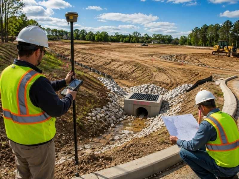
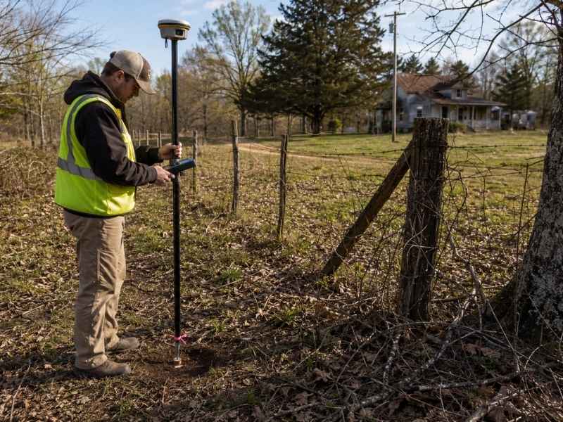
Fieldwork comes next. A crew locates the boundary, finds or sets markers, and maps the improvements the standards require.
Then the surveyor drafts the map and works out what the field data says against what the records claim. Those two rarely agree.
Review wraps it up. The buyer, the lender and the title company all read the draft, and any of them can send it back. One forgotten Table A item can send the crew back to the site.
Hand over your records at the start. Research is the only step you actually control.
What makes a survey take longer?
Some properties simply take more work. Expect a longer schedule when the site has any of these:
- Large acreage or an odd shape
- Missing or damaged boundary markers
- Thick brush, standing water or blocked access
- Lots of easements, utilities and buildings
- An old legal description that doesn’t close cleanly
- Several parcels joined into one description
- A tenant who limits when a crew can work
Access trips up more buyers than anything else on that list. A surveyor who can’t get on the property can’t finish the job. If the seller controls the gate, or a tenant needs notice, handle it before the crew schedules the trip.
Old descriptions cause another big delay. A boundary written a hundred years ago may force the surveyor to research neighboring deeds and rebuild the line from evidence. That work doesn’t speed up just because closing is near.
Why do Table A items need to be settled early?
The 2021 ALTA/NSPS standards include a list of optional items called Table A. The buyer, the lender and the title company pick which ones they want. Those picks set the scope, and the scope sets the schedule.
Common ones cover land area, contours, building sizes, parking counts, zoning setbacks and utility locations. Each one costs real field hours or research time. Utility items often need coordination with the utility owners, which drops a third party into your timeline.
Late Table A requests are the easiest delay to avoid in this whole process. When a lender decides in week five that they want contours after all, the crew goes back out. So get the lender’s survey requirements in writing before fieldwork starts, and make sure the title company agrees with the list.
A clear scope also gets you a delivery date the surveyor can stand behind. Fuzzy scopes get you fuzzy estimates.
How does the survey fit with the rest of due diligence?
The survey feeds other work, so its spot in the schedule affects more than the survey itself.
The title company reads it against the exceptions in the commitment. That comparison is what creates survey-related title objections. Push the survey late and you squeeze the time left to raise them.
Engineers and architects use the survey as the base drawing for early planning. A survey that shows up two weeks late pushes their work back two weeks. Environmental firms may need boundary and easement details as well.
Ask the lender, the title company and the design team what they need and when they need it, then work backward from closing. A team that spots a missing easement document in week two still has choices. The same team finding it in week seven is drafting an extension.
Frequently Asked Questions
How long does an ALTA survey take?
Plan on anywhere from a couple of weeks to a couple of months. Size, record quality, site access, boundary problems, Table A picks and the surveyor’s current workload all move that number. Nobody can quote you a firm date without reading the title commitment and the legal description first, so treat any estimate given before that as a rough guess.
What documents does the surveyor need to start?
Send the current title commitment with all the exception documents attached, the legal description, any old surveys, recorded plats and written instructions covering the Table A items. Buyers often send the commitment but leave out the actual easement papers, which stops the research cold. Send the documents themselves, not just the list.
Can added Table A items change the schedule?
Yes, and sometimes by a lot. Items covering utilities, contours, zoning or detailed building measurements add field hours, research or outside coordination. A request made after the crew leaves usually means another trip to the site. Lock the list before fieldwork begins.
Can we reuse an older ALTA survey?
An old survey gives the new surveyor useful background, but it rarely satisfies a lender or title company by itself. Conditions change, standards get updated, new exceptions get recorded, and the old certification names people who aren’t part of your deal. Most transactions call for a new survey or an update from a licensed surveyor.
Can fieldwork start before the title commitment arrives?
Early research and some field measurement can move ahead, and surveyors often start that way when closing is tight. The survey still can’t be finished or certified without the commitment and its exception documents. Plotting those easements against the boundary is a core part of the standards.

 Land Surveyors are professionals who measure and make precise measurements to determine the size and boundaries of a piece of real estate. While this is a simplistic definition, boundary surveying is one of the most common types of surveying related to home and land owners. If you fall into the following categories, please click on the appropriate link for more information on that subject: