
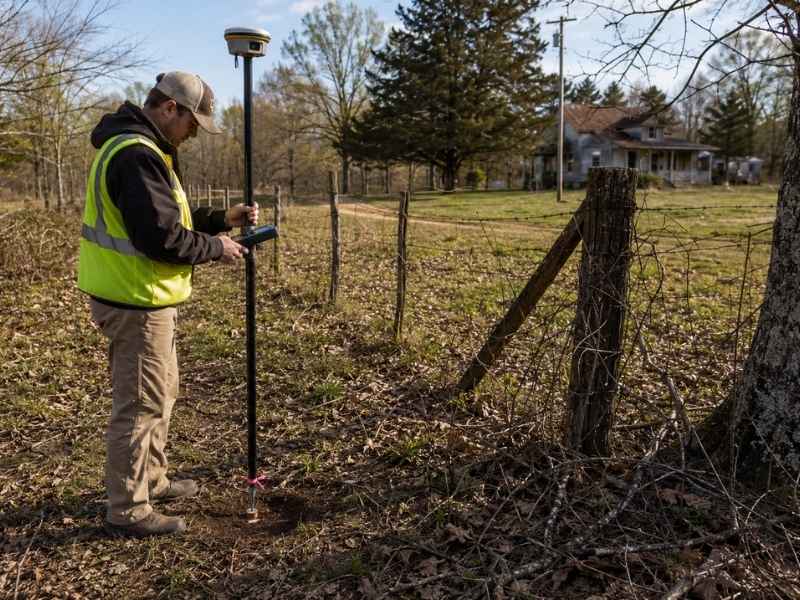
Nobody inherits a survey. People inherit land, a folder of yellowed papers and a lot of family certainty about where the property ends. A residential land survey on inherited property tends to expose the gap between those two things fast. Fences sit in the wrong place. Easements nobody mentioned run straight through the back field. Corner markers vanished decades ago.
The pattern holds almost everywhere. The longer land stays in one family, the more the paperwork and the ground drift apart. A survey closes that gap before it becomes a lawsuit, a stalled sale or a house built three feet over a line.
Why do old records make a residential land survey harder?
Inherited parcels often carry deeds written decades or even centuries ago, and those descriptions lean on landmarks that no longer exist. A residential land survey begins with record research, so missing plats and vague legal descriptions add hours before anyone sets foot on the property.
Rural descriptions cause the worst headaches. They reference a big oak, a fence post or “the old Miller place.” The oak fell in a storm. The fence rotted. The Millers sold out and left two counties over. Surveyors rebuild these lines by pulling neighboring deeds, older plats and whatever the county recorder still holds.
Heirs can cut real time off the job by gathering documents first. Useful items include:
- Deeds, wills and probate records
- Old plats or subdivision maps
- Past survey drawings, even faded ones
- Tax notices showing acreage
- Utility or right-of-way agreements
Even a grandparent’s pencil sketch helps. It can point a crew toward evidence they would otherwise spend two days hunting.
Why don’t family boundary lines match the deed?
Long use doesn’t move a written boundary. Families treat fences, tree lines and creeks as property markers, but those features rarely sit on the deed line. A residential land survey measures the record, and the record wins.
This surprises almost nobody in the profession. Land that passes through a will skips the one event that normally forces a survey. A sale brings in a lender, a title company and a fresh drawing. A funeral brings none of that.
So the crew regularly finds a fence several feet off. Driveways drift onto a neighbor’s parcel. A shed from 1978 sits right on top of a corner nobody ever checked. Adverse possession law complicates matters further, because decades of open, uninterrupted use can create a real legal claim in many states. The time period varies widely, so the family attorney reads that one, not the surveyor.
A survey won’t settle who owns what. It hands the family accurate facts and lets the lawyers work from there.
What easements show up on inherited land?
An easement gives someone else the legal right to use part of your land for a set purpose, and inherited parcels hide them constantly. A grandfather signed a utility agreement in 1958 and nobody has mentioned it since. A residential land survey shows recorded easements when the documents surface, along with visible signs of use out in the field.
Common ones include:
- Utility lines, poles and buried cable
- Shared driveways serving a landlocked parcel behind you
- Drainage ditches and stormwater paths
- Pipeline corridors and rights of way
- Access roads granted to a neighbor generations back
Crews notice the physical clues too. Truck ruts across a hayfield, a buried pipe marker or a cleared strip through the woods usually means something is recorded somewhere.
These rights start to matter the moment heirs make plans. An easement can kill a house site, block a driveway or shrink the usable acreage right before a sale. Hand your surveyor the title work and any old agreements you turn up, because that paperwork decides what ends up on the map.
Why does rural acreage take longer to survey?
Country land takes longer because the crew covers more ground under worse conditions. Briars, creek crossings, steep slopes and grown-over logging roads all slow fieldwork, and a family parcel might run 40 acres instead of a quarter acre.
A crew can spend most of a day locating a single original corner. Iron pipes sink. Stones roll downhill. Trees swallow them whole.
Older parcels bring a second problem. Whoever wrote the original description worked with a chain and a compass, so those old numbers rarely close cleanly against modern measurements. The surveyor then reconciles neighboring deeds and older plats until the pieces fit together.
Owners can speed this up. Cut a safe path where you can, and share what you remember. If an uncle knows where the corner stone once sat, say so before the crew starts searching.
What can heirs do once the survey is finished?
A current residential land survey gives every heir one accurate picture of the same property. Boundaries, buildings, access points and easements all appear on a single drawing, which unlocks nearly every decision the family faces next.
That drawing earns its cost quickly. Buyers ask for it. Lenders ask for it. Builders want it before they place a house or cut a driveway. And a family splitting land three ways can’t divide anything fairly until they know exactly what they’re dividing.
It also cools arguments down. Memory makes a terrible surveyor. Once everyone reads the same map, the conversation shifts from what Dad always said toward what the record actually shows.
Match the survey type to the plan, though. A boundary survey answers a different question than a survey prepared for a land division, so explain what you intend to do with the property before fieldwork begins. Only a licensed surveyor can certify a boundary, and every state regulates the profession for exactly that reason.
Frequently Asked Questions
Do heirs need a survey right after inheriting land?
Usually yes, especially when the paperwork looks thin or the family plans to sell, build or divide. Anyone holding the land untouched, with clean records and no close neighbors, can reasonably wait.
Can we still use a survey from 30 years ago?
Treat it as a head start rather than an answer. Markers disappear, neighbors build, utility companies move in and most lenders will reject a drawing that old.
Will a survey catch every easement?
It captures whatever the records reveal plus whatever the crew can see outdoors. An unrecorded handshake deal from 1970 stays invisible, which is why title research runs alongside the fieldwork.
What happens when the corners are gone?
The surveyor rebuilds the line using deeds, adjoining surveys, surviving monuments and physical evidence left on the ground, then sets fresh markers you can actually find.
Why does country property cost more to survey?
Hours. Large acreage, heavy brush, rough terrain and unreliable old paperwork all stack up. A tight platted lot with clean records simply takes less field time.