Topo Surveying and Topo Surveyor
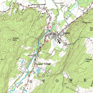
 A Topographic Surveyor also known as a Topo Surveyor collects the survey data to locate man-made and natural marks and its elevations on a particular portion of land. The topo surveyor normally includes any man-made underground marks such as utility lines, if they are marked in advance. It will also illustrate ground level installations such as utility poles, buildings, walls, and many other significant improvements.
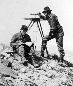
The utilization of standard topographic surveying procedures (not those shown in this image) are commonly employed to provide a precisely measured plan of the terrain. This method also includes the mapping and drawing phases of projects to document the locations and layout of the improvements, road, buildings, and many other engineering and architectural projects in the construction industry.
Why Hire a Topo Surveyor?
The purpose of getting a Topo Surveyor to do a topographic survey is to obtain an accurate map and documentation of the present state of a parcel of land that will be constructed on; either a building, a wall, or any other construction activity. The design engineers make use of the topo survey as they plan the design and then the proposed final surface.
It is important to have this plan as this allows the Engineer to compute, analyze, and estimate the amount of earthwork that might be required. The Engineer will also be able to balance the amount of earth work to minimize the dirt to be taken off or onto the construction site. An architect may also make use of the topo survey the same way as the Engineer.
Additionally, the architect may plot the surface in 3D to picture the finished look with the improvements he might add. This plot may be presented to the contractor, building owner, or the land owner before the actual construction takes place. An accurate topo survey is a big help to ensure the installations and improvements fit within the site boundaries.
Common Methods that a Topo Surveyor use
 The two common methods of doing a topographic survey are Aerial Topo Survey and Ground Based Topo Survey. How the topographic survey is done would vary depending on the size of the project and the contour interval desired. It is important that a topo surveyor understand how to carry out both in any circumstances. Choosing the proper method, based on the project requirements is an important decision that the topo surveyor should be able to help with. Having been involved in both types of topo surveys will allow the topo surveyor to make use of the most appropriate method.
An Aerial Topographic Survey is done from a point above the ground surface using either a plane, helicopter, un-manned aerial vehicle, or a crane to get the aerial camera above the ground. The distance above the ground is determined by the precision needed for the topo survey. Aerial photos of the ground surface are then taken and examined by a photogrammetrists who does the mapping from these stereo pairs of photos. By looking at the two overlapping aerial photos, the improvements and breaklines are gathered.
A Ground Based or Conventional Topographic Survey is done when there is a need to get more precise contours and spot elevations or if the site is small. The Aerial Topographic Survey is limited in the precise vertical and horizontal point location on the ground surface. This a somewhat simplified discussion of the two methods of completing a topographic survey. While this is an overview, you should read and research more if you desire to learn in depth about topographic surveys. Or, just talk to a topo surveyor.
