What an As-Built Survey Captures After Construction Ends


 As-built survey of a completed commercial building with a surveyor using a total station to document final site conditions after construction ends.

Plans show how a project is supposed to turn out. Real construction does not always follow the plan exactly. An as-built survey is the record of what was truly built. It shows where things sit and how they differ from the original drawings. It is the final, measured picture of a finished project. For owners, builders, and local offices, that record settles questions long after the crew leaves.

What an As-Built Survey Is

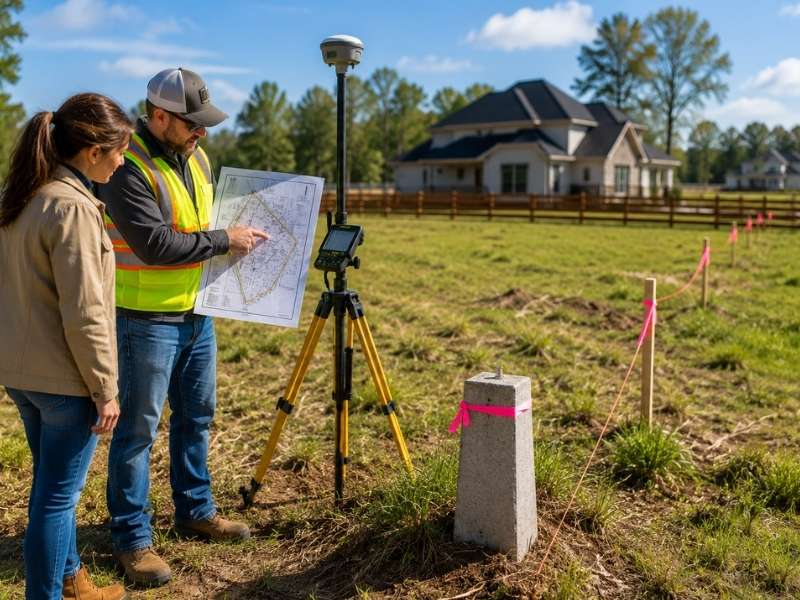
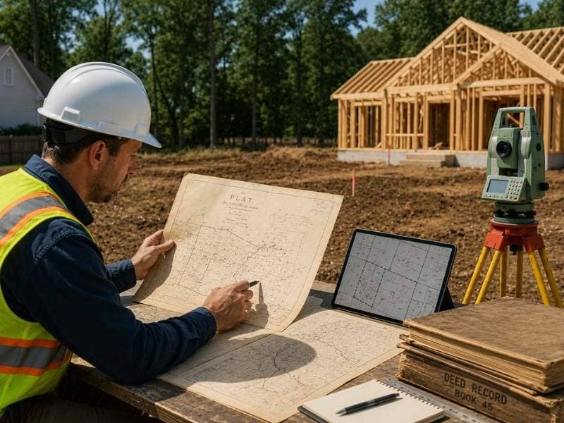
An as-built survey is a record a surveyor makes after the work is done. The surveyor visits the finished site and maps where everything ended up. The result is a drawing that shows reality, not just the plan that started the job. It becomes the real record of how the project came together.

A typical as-built survey can record:

  • The final position of buildings and structures on the lot
  • Driveways, walkways, and parking in their finished spots
  • Utility lines and connections in their installed positions
  • Grading, drainage features, and finished ground heights
  • Setbacks and distances from the property lines

Each of these can shift during construction. The survey pins down the real numbers so no one has to guess later.

Where the Build Differs From the Plan

Almost no project ends exactly as drawn. A wall moves a foot to clear a pipe. A slab shifts to dodge bad soil. A utility takes a different route than planned. These small changes add up. The old drawings no longer match the site. The survey records each change so the paperwork tells the truth.

This matters more than it looks. A future contractor who trusts the old plans could dig in the wrong spot. They might design around a wall that is not there. With an accurate as-built, everyone works from what is real. That saves time, money, and a lot of frustration down the road.

Underground and Utility Records

Some of the most useful survey data is the part you cannot see. Once a crew fills a trench, the pipes and lines below vanish from view. The survey records where those utilities run before the dirt covers them. That map can save a crew from cutting a line years later.

Water, sewer, power, and drainage all meet the real ground during the build. Their final paths rarely match the drawings down to the inch. Recording the true spots protects the next project and the people who dig for it. It is far cheaper than finding a line the hard way.

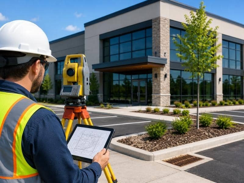
Confirming the Work Meets the Approved Plan

The survey also checks that the finished project follows the approved rules. It shows whether the building kept its required distance from each line. It confirms that nothing crossed an easement or went past the approved footprint. Local offices often want this proof before they close a permit.

Catching a problem here is far better than catching it later. If a structure sits too close to a line, the owner wants to know now. A future sale is the wrong time to find out. The survey turns a vague hope into a documented fact. That record can head off a dispute years before it starts.

A Record That Pays Off Later

An as-built survey keeps working long after the project ends. When an owner plans an addition, the survey shows what is already there. When a buyer or lender has questions about the build, the answer is on file. A clear record turns hard questions into simple ones.

Maintenance gets easier too. A leak, a repair, or a new connection all go smoother when the survey maps the lines and structures. Instead of opening the ground to find out, a crew can check the survey first. One accurate record can save many headaches over the life of a property.

Frequently Asked Questions

What does an as-built survey include?

An as-built survey includes the final spots of buildings, paving, utilities, grading, and property lines. It records the project as crews actually built it, not as it first appeared on the plans. The result is a clear record of the finished site.

How is an as-built survey different from the original construction plans?

The original plans show the planned design before any work begins. An as-built survey shows the real result after construction. It includes any changes made along the way. One is the goal, and the other is the proof of what happened.

When is an as-built survey done?

A surveyor completes an as-built survey once construction is finished, or at the end of a major phase. By then the structures, paving, and utilities are in their final spots. That timing lets the survey capture the true, final state of the site.

Does an as-built survey show underground utilities?

Yes, recording utility locations is one of its most useful jobs. Surveyors capture where pipes and lines run, ideally before crews cover the trenches. That map helps future crews avoid cutting a line by accident.

Who needs an as-built survey?

Owners, builders, engineers, lenders, and local permit offices all rely on as-built records. Each one needs proof of how and where a project came together. The survey gives them a single trusted source for those facts.

Is an as-built survey required to close out a project?

On many projects, yes. Local offices often want one before they sign off. It confirms the finished work matches the approved plan and rules. Even when it is not required, it is a smart record to keep.

Land Surveying for Homebuyers Moving on a Tight Timeline

Land surveying helps homebuyers on a tight timeline verify property boundaries, review lot features, and avoid delays before closing.

Land surveying might be the last thing on your mind when you need to buy a home fast. A job change or a moving deadline can squeeze months of decisions into a few weeks. In that scramble, a survey can feel like one more delay. It works the other way around. A clear survey early on keeps a fast purchase from turning into a slow, painful mess. It hands you the facts you need to decide quickly and move with confidence.

How Land Surveying Helps Homebuyers Stay on a Tight Schedule

The key to surveying on a deadline is starting it early. A survey takes time to schedule, complete and review. Order it the day you go under contract, not the week before closing. That head start keeps it from becoming the thing everyone waits on.

A survey also clears questions that would otherwise stall the deal. Lenders and title companies often want one before they finish their work. Hand it to them early, and their part moves faster. Wait, and you risk a backlog right when the clock runs short.

Treat the survey like any other deadline on the calendar. Know how long it takes in your area and book it the moment you can. A buyer who plans for it keeps a tight timeline intact. A buyer who forgets it often loses days it can’t afford to lose.

Why Land Surveying Helps Buyers Understand the Property Better

A home is more than the house. It sits on a lot with edges, rules and quirks that affect what you can do. Land surveying shows how the house fits on that lot, not just where the boundaries fall.

That fit matters more than buyers expect. A survey can reveal that a deck or shed crosses a property line, or that the house sits closer to the edge than the rules allow. It can also show an easement running right through the backyard, where a utility has the right to dig. These details shape how you’ll live there and what you can change.

For a fast-moving buyer, this picture is gold. You learn in one document whether the home is what it appears to be. There’s no slow back-and-forth, no piecing it together from a listing. The survey tells you what you’re really buying, lot and all.

How Land Surveying Supports Buyers in a Busy Housing Market

A hot market pushes buyers to act fast and skip steps. Homes sell in days, and offers pile up. To win, people waive inspections and rush their checks. That is where a survey earns its keep.

A survey lets you move quickly without going in blind. It gives you solid facts about the lot while the pressure is on to decide now. You can make a strong, confident offer because you know exactly what the property holds. Guesswork in a bidding war is how buyers overpay or inherit a problem.

Speed and care don’t have to clash. A survey is one of the few checks that delivers hard answers fast. In a market that rewards quick moves, that mix of speed and certainty gives a buyer a real edge.

Why Land Surveying Can Help Prevent Last-Minute Problems

Most deals that fall apart at the last minute do so over surprises. A boundary issue or an encroachment shows up during the title check, and suddenly closing is in doubt. A survey done early catches these problems while there’s still time to solve them.

Lenders are part of this too. Many won’t fund a loan until a survey clears certain questions about the property. If that survey arrives late and turns up an issue, the financing can stall on the very day you meant to close. Finding the same issue weeks earlier gives everyone room to work it out.

The pattern is simple. Problems found early are problems you can fix. Problems found at the closing table are problems that blow up your schedule. For a buyer racing a deadline, an early survey is cheap insurance against a last-day disaster.

How Land Surveying Gives Buyers More Peace of Mind

Moving fast can leave a buyer uneasy. You’re making a huge decision in a short window, and doubt creeps in. You wonder if you missed something. A survey quiets that worry with plain facts.

When you hold a clear survey, you know the boundaries are real and the lot is what you think it is. That certainty is worth a lot during a rushed move. It replaces a nagging what-if with a simple answer. You can sign knowing the ground you’re buying matches the deal you made.

Confidence like that carries past closing day. You settle in without wondering whether a fence is in the wrong place or a neighbor’s drive crosses your land. The survey did that checking for you. In a fast purchase, that calm is one of the best things money can buy.

Frequently Asked Questions

Why is land surveying important for homebuyers who are moving on a tight timeline?

It delivers hard facts about the property early, when fast decisions matter most. With the boundaries and lot details in hand, a buyer can act without second-guessing. That saves the delays that come from missing information.

How does land surveying help buyers understand the property?

A survey maps the lot’s edges and shows how the house and other features sit within them. It points out things like easements or a structure that crosses a line. This gives a buyer a true picture of the home and land together.

Why is land surveying useful when homes are selling quickly?

In a fast market, buyers have little time to study a property before bidding. A survey supplies reliable facts quickly, so an offer rests on real information. That helps a buyer compete without taking a blind risk.

How can land surveying help prevent problems before closing?

Boundary and encroachment issues often appear during the title or loan review. A survey done early surfaces them while there’s still time to fix them. That keeps a surprise from derailing the deal on closing day.

Why does land surveying give buyers more peace of mind?

A survey replaces guesswork with clear, verified facts about the lot. Knowing the boundaries are accurate eases the stress of a quick purchase. The buyer can move forward feeling sure about what they bought.

Why a Licensed Surveyor Should Review Old Plats Before You Build

Licensed surveyor reviewing old plats and property records before building on a residential construction site.

A licensed surveyor often starts a project by looking at old plats. This happens long before any equipment touches the ground. These maps show how a piece of land was divided years ago. Land changes over time. An old plat cannot always show this. Roads shift. Fences move. Nearby lots get split or combined. A licensed surveyor checks the old plat against what is really out there. This step helps builders avoid costly surprises before construction begins.

Why Old Plats May Not Show What Is There Today

Old plats can become outdated over time. A map drawn decades ago shows the land as it existed back then. It does not show how the land looks today. Roads get wider. Roads also change direction. Fences get added, moved, or removed. Owners may split or combine nearby lots. They may also rebuild them. The old plat never records these changes. A licensed surveyor compares the old plat with the actual ground today. This step catches differences early.

Missing Corner Markers Can Make Building Harder

Property markers on an old plat do not always survive the years. Time and weather can bury a corner marker underground. Landscaping work can knock a marker loose. It can also remove a marker completely. Once a marker disappears, the property line becomes harder to confirm. A licensed surveyor knows how to find these corners again. They check old records. They check nearby markers too. They also take careful measurements. This work gives builders a clear, confirmed line for new structures.

Older Lots May Have Records That Are Hard to Read

Some old plats and deeds use language that feels confusing today. Some use old measurements too. Faded ink and old handwriting make these records hard to follow. Some records leave out details. Others describe them only partway. A licensed surveyor knows how to read these older documents. They understand the methods surveyors used long ago. This skill turns a confusing record into a clear picture of the property.

Inherited Property Can Bring Up New Questions

Families often pass land down through generations. This land often comes with old maps and records. These records may describe boundaries differently than how the land looks now. New owners may not know exactly where their property begins and ends. A licensed surveyor can review these older records. They explain what the records actually mean today. This step gives inherited property owners a clearer picture before they make any changes.

Checking Old Plats Early Can Help Avoid Delays

Reviewing old plats early gives everyone more time to catch problems. A missing marker can slow down a project. So can an outdated boundary line. A confusing deed causes the same problem. These issues cause the most trouble when nobody catches them until later. A licensed surveyor finds these issues before equipment arrives on site. Catching a problem early on paper costs far less. Fixing it once construction starts costs much more.

Frequently Asked Questions

What is an old plat?

An old plat is a map. It shows how land was divided many years ago. A licensed surveyor uses this map as a starting point before checking current conditions.

Why should a licensed surveyor review an old plat?

A licensed surveyor compares old records with current conditions. This shows whether anything changed since the plat was made. It helps builders avoid relying on outdated information.

Can old plats be wrong?

Old plats are useful, but they may not show changes over time. Roads, fences, and nearby lots can shift years later. A licensed surveyor checks the plat against the site today.

Why do inherited properties need extra review?

Inherited land may come with old records or missing markers. Family members may not know the full history behind the lines. A licensed surveyor reviews these records and explains what they mean.

Should I contact a licensed surveyor before building on an older lot?

Yes. A licensed surveyor can review old plats and explain the property to you. This step often catches problems early, when they cost less to fix.